How Satellite Camera Helps Fight Against Climate Change

Employing remote sensing technology, a satellite camera gathers data on how our planet’s environment is changing. Now, you might ask, is the Earth’s climate changing story real? Yes, our planet suffers environmental changes, but we have climate change satellites standing guard. Satellite camera can help us identify and locate these changes. The more scientists analyse what’s happening with our environment, the more we can do something to ensure our planet’s future looks promising.
How are satellites used in environmental monitoring?
From low Earth orbit, we can take satellite measurements of sea levels, greenhouse gas emissions, ocean levels, etc. NOA, ESA, and NASA are space organizations that use smallsat cameras to monitor clouds, ocean conditions, heat content, sea levels, temperature, etc. Their purpose is to interpret data on how Earth’s temperature is changing and more. Smallsat cameras take images and use remote sensing technologies to collect this data. Then, they transmit it further so that scientists can interpret it. Satellites and space technology also work to mitigate the effects of climate change by collecting essential information on our environment. With this information, governments and organisations worldwide make necessary changes to help us survive as a species and live in comfortable conditions. Smallsat environmental monitoring is part of our lives and helps us build a better planet.
What can a satellite picture tell us about the climate?
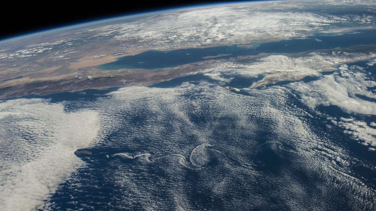
Climate change satellite images come from both advanced, high-resolution cameras. Infrared climate change satellite data is also available through camera imagery. It measures the temperature and coverage of clouds to identify where rain might fall. By analysing successive camera images of how clouds are moving, weather experts can determine the direction and speed of winds. Smallsat camera images can also tell us a lot about pollution, dust storms, fog, the extent of ice at the poles, volcanic ash, and most other environmental changes. For example, satellite images were very useful during events like the Buncefield explosion in London in December 2005 and the Eyjafjallajökull volcano eruption in Iceland in April 2010. Back then, we could see where ash clouds were spreading and take precautionary measures for locals to remain safe.
Which satellite camera is used for climate monitoring?
A satellite camera for monitoring climate change is a technologically advanced camera that takes hyperspectral images and can withstand space weather. Hyperspectral imagery is not a new technology. However, in the past, only very expensive and large satellites were capable of equipping it. A hyperspectral camera can also take infrared images. Hyperspectral cameras are based on the Fabry-Perot tunable interferometer that functions like an optical spectrometer with high-resolution capabilities. Private space companies develop different hyperspectral satellite camera models and compete to come up with advanced prototypes. The most impressive information gathered with hyperspectral infrared cameras is about biomass content, rock species, and chemicals in our environment. In addition, this type of camera works to monitor greenhouse gas composition and the health of vegetation in different areas.
How do satellites monitor climate change?
As mentioned, satellite data is crucial for scientists and weather experts worldwide because it provides information about climate change. Smallsat cameras that analyse environmental changes work 24/7. They orbit the planet, using enhanced temporal and optical resolutions to improve weather forecasting, get an insight into climate modelling, and provide results in real-time. The dataset obtained by smallsat cameras is a quantitative and digital description of the climate. To put it more simply, it’s a description made with remote sensing technology and imagery. Without smallsat cameras monitoring climate change, no weather channel would be able to tell you how your day is going to be.
Do satellites cause global warming?
You might have all sorts of ideas about climate change affecting satellites or satellites causing global warming. Rest assured, neither of these two things is possible. Satellites are in low Earth orbit, and only space weather can influence them. Down here on the planet, we are not influenced by space weather either. Earth has a magnetic field, which is the activity of the magnetic force that separates us from the space environment. Besides, our planet is also surrounded by an atmosphere. The magnetic field and atmosphere are our protective superheroes that also ensure there’s no blast of solar wind damaging us. So, there’s no way satellites can cause global warming because they are in space and don’t take up any of the planet’s resources. On the contrary, satellite cameras that monitor the environment are only useful in the fight against global warming, as these cameras send us the most accurate data about this phenomenon.
Thanks to the work of many scientists and space engineers, the Earth now has satellite camera capabilities to monitor the environment. Data gathered by satellites in low Earth orbit tells us a lot about what we should do for our planet not to suffer any major climate changes or natural disasters.